LPBF Launches Hydrocoast Maps to Monitor Conditions in Barataria Basin
Due to popular demand, the Lake Pontchartrain Basin Foundation has created Hydrocoast Maps for Barataria Basin. As it has done in neighboring Pontchartrain Basin, the maps for the Barataria Basin will monitor the salinity, freshwater input, weather and fisheries in order to gain a deeper understanding of estuarine dynamics, changes to the basin over time and to provide a baseline to monitor future changes as restoration projects are completed.
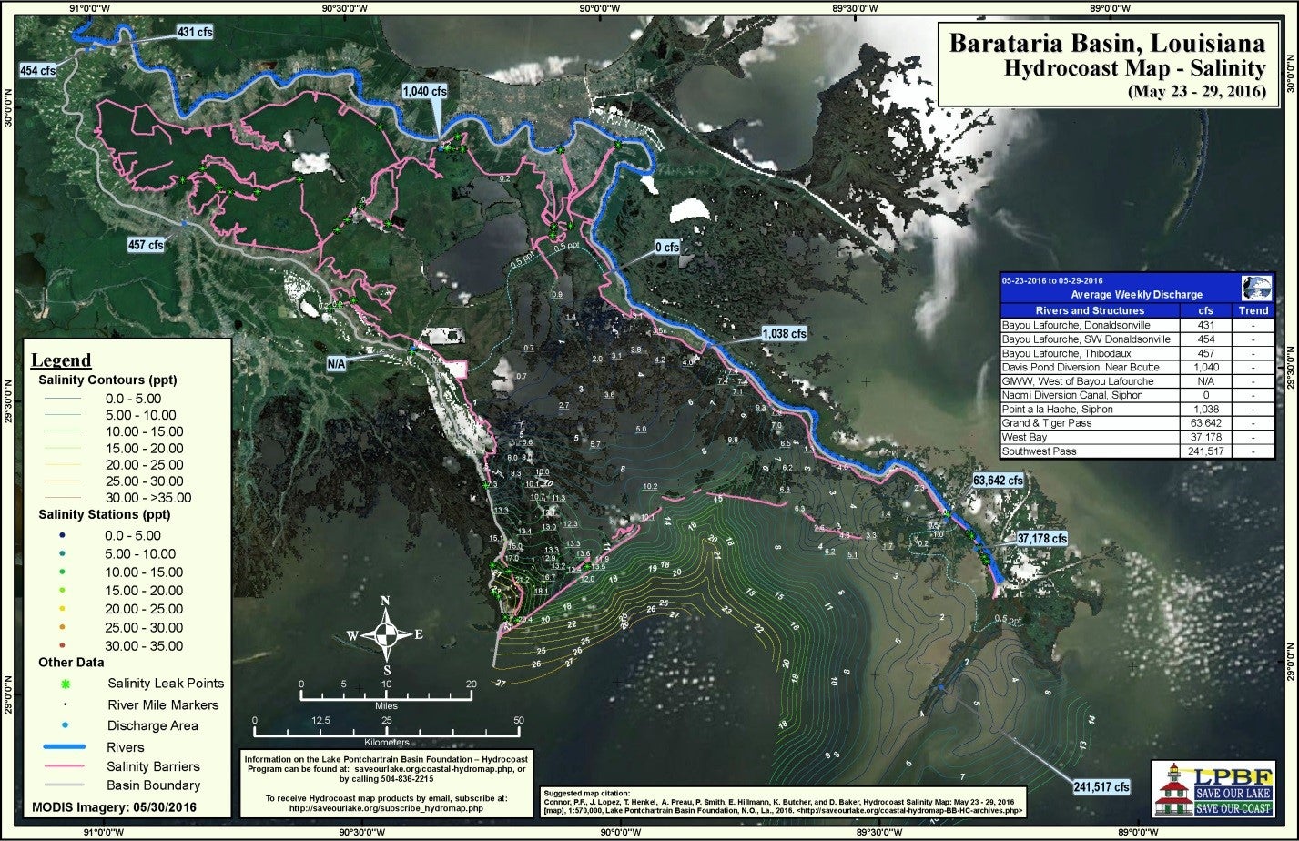
Hydrocoast Maps provide a snapshot of the conditions of the estuary, such as the distribution of saline to fresh water. The maps are designed to be useful to a diverse audience including the general public, fishers, agency personnel and academics. By expanding into the Barataria Basin, people that work and recreate there can benefit from the maps as those in the Pontchartrain Basin already do.
The Barataria Hydrocoast maps will consist of the following maps and analyze:
- Salinity Map – isohalines (lines on maps connecting points of equal salinity) and freshwater inflows
- Weather Map – cumulative rainfall and wind data
- Biological Map – fisheries fleets and closures, impaired waters for fishing
The Barataria Hydrocoast Maps will be surveyed and released every eight weeks on the following schedule:
- July 18-24
- September 12-18
- November 7-13
- January 2-8
- February 27 – March 5
Learn more and access the Barataria Basin and Pontchartrain Basin maps at www.saveourlake.org/coastal-hydromap.php
Dr. Theryn Henkel is currently the Assistant Director for the Coastal Sustainability Program at the Lake Pontchartrain Basin Foundation, a local not-for-profit located in New Orleans, Louisiana. Theryn completed her undergraduate studies in environmental science at the University of Long Island at Southampton then went on to complete her Master’s Degrees in Applied Ecology at Indiana University. She obtained her Doctorate degree at Tulane University in Ecology, focusing on forested wetland recovery from damage caused by hurricanes. She is currently involved in projects that investigate the effects of “legacy river diversions”, wetland loss, reforestation and the development and evolution of created wetlands in an urban environment. Theryn is originally from Seattle, Washington, where she grew up enjoying all the outdoor activities that are available in that beautiful region of the United States.