A View from Above: Join us for a Flyover Along the Mississippi River
Hello there! Welcome to your personalized flight across Louisiana’s coast. Here at Restore the Mississippi River Delta, we work daily to confront Louisiana’s land loss crisis by advancing large-scale coastal restoration projects to build and sustain land.
Louisiana is losing a football field of land every 100 minutes. Since the 1930s, we’ve lost land equivalent to the size of Delaware. Without bold action, Louisiana could lose another 4,000 square miles over the next 50 years. We have no time to lose, and we must act urgently to address this crisis. Louisiana’s Coastal Protection and Restoration Authority, commonly referred to as CPRA, has developed a Coastal Master Plan using the best available science to guide our work toward a sustainable coast.
The scale of Louisiana’s land loss crisis – and the work being done to preserve it – can be hard to grasp from the ground. One of the best education and advocacy tools for coastal restoration is fly people over the coast to see the scale and impacts of our land loss crisis. From the sky, the immensity of the task in front of us is laid bare. While we can’t bring everyone up on a plane, we can do our best to bring that perspective to you here. In the following blog series, we’ll follow a virtual flyover path down the lower Mississippi River. At each stop, we’ll look at past and future projects impacting our coastline.
Takeoff
 Copyright: Kevin O’Mara
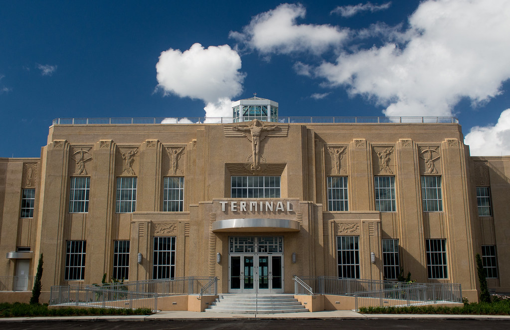
Our virtual flight will take off from the historic New Orleans Lakefront Airport.
Before we leave the New Orleans airspace we can see the Wetland Triangle (represented by the green triangle in the map below), where Bayou Bienvenue (shown in turquoise) begins to snake along the wetlands that make up the border of Orleans and St. Bernard Parishes, ending in Lake Borgne.
Saltwater intrusion, caused by the construction of the Mississippi River Gulf Outlet (MRGO) in the 1960s, killed the cypress swamp in the Lower 9th Ward and destroyed tens of thousands of acres of wetlands that once protected the Greater New Orleans area. The MRGO channel and the loss of the surrounding wetlands are attributed to the catastrophic flooding that occurred in the Lower Ninth Ward and surrounding communities during Hurricane Katrina in 2005.
Following the devastation of Hurricane Katrina, renowned Louisiana coastal scientists released a report detailing the impacts of the MRGO channel and recommending its closure. In this same year the MRGO Must Go Coalition – a group of 17 local and national NGOs and community organizations – was formed to advocate for the closure of the outlet and restoration of the ecosystem.
This coalition led one of the most successful advocacy campaigns in Louisiana history, generating a record 75,000 public comments in support of MRGO Must Go recommendations. By 2009, the channel was closed with a rock dam near Bayou La Loutre and a $1.1 billion surge barrier across the MRGO funnel was officially completed in 2013. These closures have moderated surface water salinity, setting the stage for large-scale ecosystem restoration in the area.
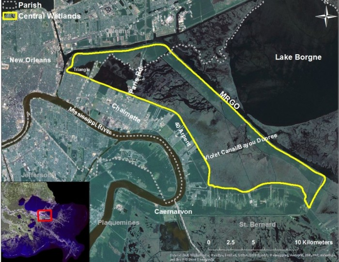
Caption: Location of the Central Wetlands in the Pontchartrain Basin. The wetlands are surrounded by impoundments including the MRGO, 40 Arpent Levee and the newly built hurricane protection system around New Orleans.
As we move further southeast of New Orleans, we transition to the Central Wetlands, nearly 30,000 acres of wetland area that was once mostly a mix of cypress tupelo swamp and bottomland hardwood forest. This area has been dramatically affected by man-made forces. Logging in the early 1900’s removed swamp and left behind logging ditches scarring the landscape (left). Indicators of the dynamic salinity history can be seen with dead oysters (salty species) are present on a dead cypress stump (fresh species) (right). You can learn more about the importance of the Central Wetlands on ScienceForOurCoast.org.
When flying south out of New Orleans, the city’s proximity to coastal wetlands is immediately evident. New Orleans is, essentially, a coastal city. Wetlands essentially serve as natural sponges, buffering communities against storm surge and slowing the speed of floodwaters. Wetlands like the Golden Triangle also have the benefit of absorbing water runoff and distributing it across the floodplain. But as the wetlands disappear, so does the natural protection it provides our communities. Large-scale restoration projects, along with coastal protection and community resiliency measures, are our best solutions for reducing land loss and protecting our communities and cities.
 Sign welcoming visitors to the viewing platform at the end of Caffin Avenue in the Lower Ninth Ward overlooking Bayou Bienvenue Wetland Triangle. Photo Credit: Jacques Hebert


Next up in our blog series, we’ll take a look at the HSDRSS Storm Surge Barrier and the Golden Triangle Marsh Creation Project.