How Does the Coastal Master Plan Impact Me?
Earlier this month, the Louisiana Coastal Protection and Restoration Authority released its draft 2023 Coastal Master Plan (CMP). This plan serves as a guide for Louisiana’s coastal restoration and risk reduction efforts and is released every 6 years. The plan is the end product of thousands of hours of engineering, research and modeling to determine how to best spend Louisiana’s resources over the next 50 years in the face of climate change, sea level rise and land loss.
At 100 pages long (and over 2,000 pages in attachments, appendices, and supplemental material), the CMP can be a daunting bureaucratic document. Fortunately, the CPRA has updated one of their best digital tools: Master Plan Data Viewer (the viewer).
The viewer visualizes various components of what makes the CMP one of the best and most innovative climate change adaptation plans on the planet. Through the viewer we can look at Louisiana’s land loss dating back from 1932 to the present and the PROJECTED land loss through 2073.
 Louisiana 1932 from the Master Plan Data Viewer. Louisiana's map has changed significantly over the past century, with what was land changing into open water in many areas.


This comprehensive look at the history and future of our coast expresses the full extent of the crisis before us and the viewer allows us to dig deeper. A guided tour shows how Louisiana’s land loss over the next fifty years could influence a 50-year flood event.
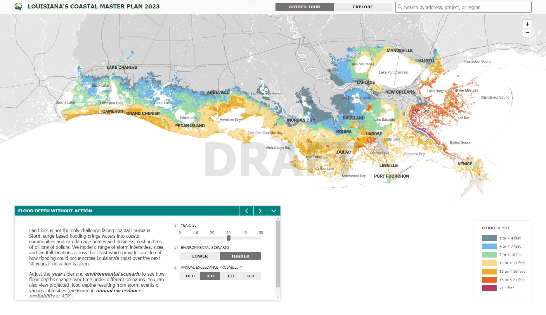
The guided tour of the viewer provides insight into the ultimate purpose of the CMP — that it is first and foremost a plan of action, addressing land loss and flood risk throughout the coast.
Below you can see when and where different projects are listed in the Master Plan.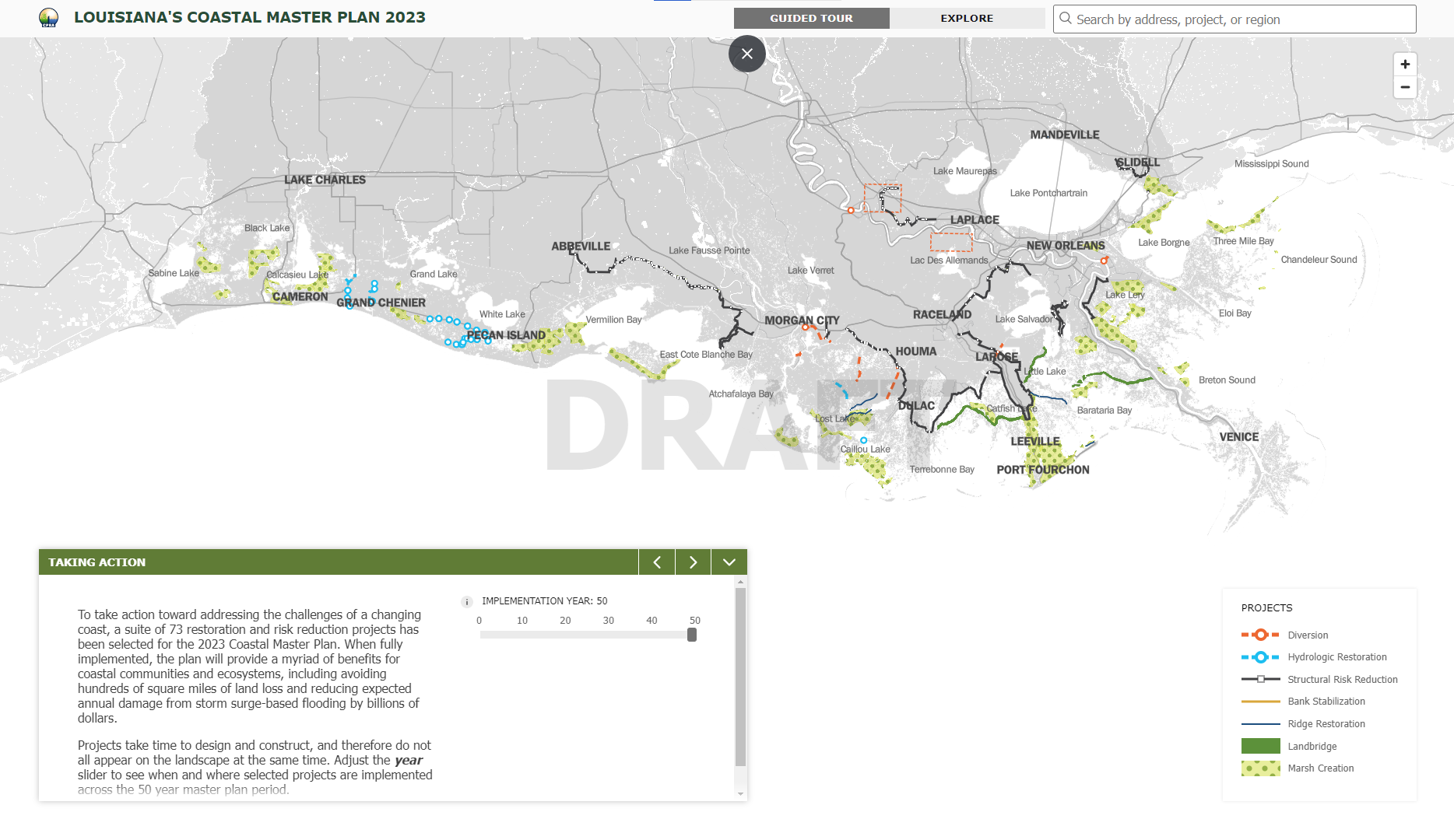
How Does the CMP Impact Me?
Beyond the guided tour, the viewer allows you to drill in and understand how the CMP impacts your neighborhood. As an example, we’ll use Chauvin, Louisiana, which is found in the Terrebonne Basin. You can focus on the land loss projections for Terrebonne by using the search bar in the top right-hand corner of the screen to search by region.
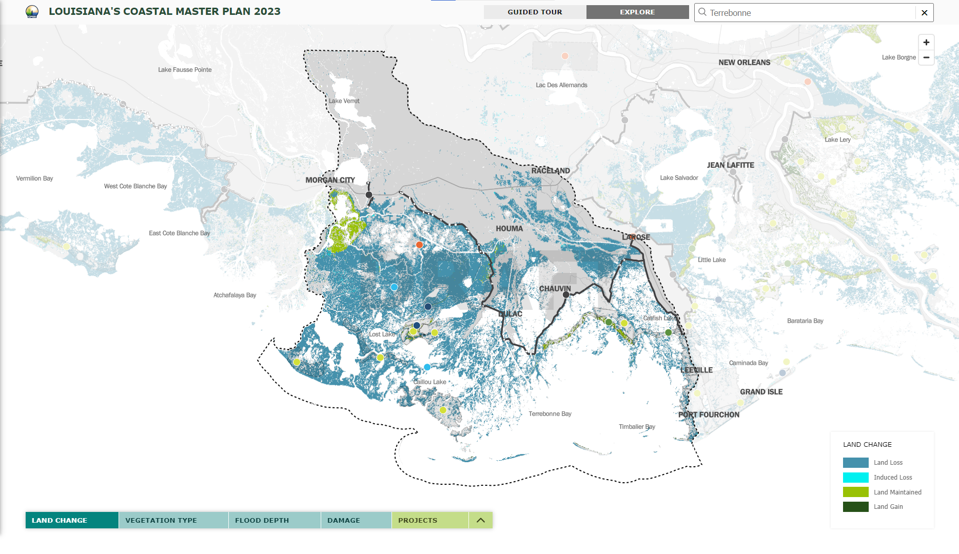
We can then search for the city of Chauvin (or even a specific address anywhere in the state) and see the area’s flood risk in any time frame over the 50-year window. Here we can see the difference in a 100-year flood event. Without the CMP, that flood could top 16 feet while with the projects in place from the CMP, the height goes down to 7 feet.


What makes that difference? In the final tab of the viewer, you can see the implementation schedule for CMP projects. Projects like the Morganza to the Gulf structural risk reduction project play a vital role in mitigating future flood risks for Chauvin. Other nearby projects include the Eastern Terrebonne Landbridge and the North Terrebonne Bay Marsh Creation project.
View the proposed projects on the Master Plan Data Viewer here
Get Involved!
The release of the draft Coastal Master Plan is the first of many steps to enact this plan for Louisiana’s future. If you want to get involved join our mailing list below or attend onone of the four formal public hearings offered by the CPRA. These hearings will provide coastal Louisiana residents and stakeholders an opportunity to review and comment on the 2023 Draft Coastal Master Plan.
The schedule for public hearings is as follows:
Baton Rouge
January 31, 2023
East Baton Rouge Parish Library
9200 Bluebonnet Boulevard
Houma
February 2, 2023
Houma Municipal Auditorium
880 Verret Street
New Orleans
February 7, 2023
University of New Orleans
University Center Auditorium
2000 Lakeshore Drive
Lake Charles
February 16, 2023
Burton Coliseum Complex
7001 Gulf Highway