Pedal Through Da Parish and learn About Louisiana’s Coast
A journey to the End of the World
If you’re not in a hurry to get to the End of the World, it’s an enjoyable trip to make by bicycle.
A 65-mile round trip from New Orleans is a marina in Delacroix Island nicknamed “End of the World.” St. Bernard Parish is a great place not far from New Orleans to experience coastal cultures and wildlife. Exploring the coast on a bike allows you to get an up close experience of Louisiana’s coastline, which is rapidly disappearing due to a number of factors including saltwater intrusion, subsidence and sea level rise.
The route to Delacroix Island requires sharing the road with some traffic. But there’s a wide shoulder most of the way and some sections are closed off to automobiles with roadblocks. You can avoid heavier traffic by getting an early start.
Delacroix Island — southeast of New Orleans in St. Bernard Parish — is not so much an island as it is a bit of high ground surrounded by wetlands. Still, Delacroix was only accessible by boat until the 1930s, when a road was built connecting the landmass to the outside world.
People in the area have historically made their living off trapping, fishing and hunting. On a recent Sunday morning, duck hunters returned to the dock, crab traps floated in Bayou Terre aux Boeufs and fishers casted their lines from the side of the road, while a nutria hid in a clump of water hyacinth.
Saltwater intrusion and wind erosion are eating away at the coastline of Delacroix Island. Hurricanes Katrina and Rita exposed the island to more erosion when they tore through wetlands protecting the area.
If marsh restoration and flood protection aren’t carried out, St. Bernard Parish stands to lose over 70% of its landmass over the next 50 years. Thankfully, there are a number of coastal restoration projects that are advancing across the parish and region. In the Delacroix area, the South Lake Lery Shoreline and Marsh Restoration project restored 652 acres of marsh and the Mid Breton Land Bridge Marsh Creation and Terracing project will create 451 acres of intertidal marsh on the border of Plaquemines and St. Bernard Parishes.
Other large-scale projects moving forward include the Biloxi Marsh Living Shoreline project and the Lake Borgne Marsh Creation project — the largest marsh creation project to be built in Louisiana. Construction on the 2800-acre marsh creation project is scheduled to begin in 2021.
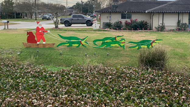
Christmas decoration seen in St. Bernard Parish on a bike ride to the End of the World.
Pedal down St. Bernard Highway and you’ll ride through the Tunnel of Trees, a stretch of road encapsulated in the outstretched arms of oaks. You’ll pass the Los Isleños Museum off Louisiana Highway 300. The museum celebrates the different cultures of those who shaped the area, including members of the United Houma Nation and immigrants from the Canary Islands and the Philippines.
The End of the World is beyond the floodwalls. Most of the permanent residents of Delacroix Island rebuilt inside the floodwalls after Hurricane Katrina. Now, the marina is surrounded by fishing camps on stilts. The sign marking the End of the World is a common photo op. But the sign recently went missing, likely the work of vandals who were not satisfied with a photo alone.
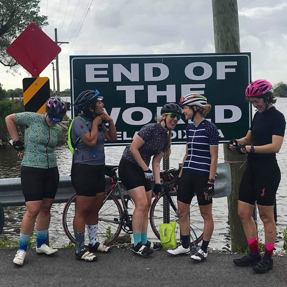
The author, far right, on a bike ride with friends to the End of the World in 2019.
On the first weekend of November, cyclists flocked to St. Bernard Parish to ride to the End of the World together. The event, called the Tour Da Parish, has taken place for six years, said David Huff, the Chairman of the tour. This year more than 400 cyclists registered for the event, which offers shorter routes for a wide range of skills. Riders celebrated reaching the End of the World afterward at the Los Isleños Heritage Site.
Soon cyclists will also have a smooth ride on top of the east Mississippi River Levee from Valero Refinery in Meraux to Violet. The Meraux Foundation donated land for a trailhead near the Violet Canal, which also provides space for parking and an American with Disabilities Act compliant ramp. The path is part of an overall plan to make the parish more accessible by bicycle.
If you are riding self supported to the End of the World, you can resupply at Last Stop Food Mart off Highway 46 on the way back to New Orleans. The store makes hot food items and has a restroom for customers. Taking Highway 46 shoulder back to New Orleans avoids the afternoon traffic on St. Bernard Highway.
If you’re looking for more opportunities to get outside and learn about the coast, check out the Coastal Land Loss Bike Tour in Baton Rouge. The 40-minute tour includes stops at the Native American mound at Louisiana State University and the Louisiana State Capitol building.
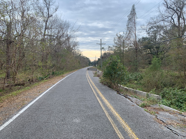
A section of Louisiana 300 on the way to the End of the World narrows and is closed off to traffic.
Take the route yourself on Google Maps!
Sara Sneath is an award-winning environmental reporter based in New Orleans. Email her tips at saraksneath@gmail.com and follow her on Twitter @sarasneath.