View From Above: Neptune Pass
The scale of Louisiana’s land loss crisis – and the work being done to preserve it – can be hard to grasp from the ground. One of the best education and advocacy tools for coastal restoration is to fly people over the coast to see the scale and impacts of our land loss crisis. While we can’t bring everyone up on a plane, we can do our best to bring that perspective to you here. In this blog series, we are following a virtual flyover path down the lower Mississippi River and looking at past and future projects impacting our coastline. Check out the other posts in this series.
For our next virtual stop on this tour of the Mississippi River’s final twists and turns, we don’t have to go far. Just south of the Bohemia Spillway, on the East side of the river is Neptune Pass. This new outlet to the river is racking up more superlatives than I can keep up. Here’s a few things you should know.
- In six years, Neptune Pass went from being a small canal on the bank of the Mississippi to a channel with a flow rate five times larger than the Hudson River.
- Neptune Pass diverts roughly 16% of the Mississippi River’s total flow.
- Mardi Gras Pass, the focus of our last stop diverts 25,000 cubic feet of water per second. Neptune is currently over 118,600 cfps.
- Taken by volume alone, Neptune Pass would be one of the 15 largest rivers in the world by volume.
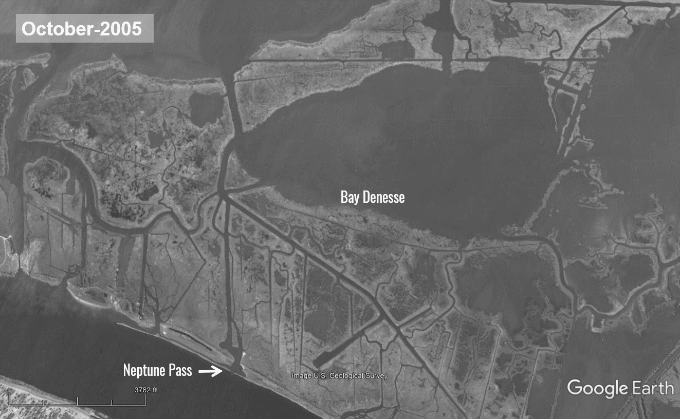
Neptune Pass shares many similarities with Mardi Gras Pass, but with two major differences. The amount of water and sediment flowing through the pass is significantly higher in Neptune Pass and we’re much earlier in the life cycle of the burgeoning deltaic effects. Just as Mardi Gras Pass broke through after the Mississippi River floods of 2011, Neptune Pass grew from a small outlet along the bank of the river to this 850-foot-wide distributary after several years of high water years for the river, culminating in 2019, when the Mississippi River was above flood stage for over 235 days.
You can see in the photos below just how rapidly the channel has grown since 2019 – and how much sediment has been deposited in just a few years.
We went out to Neptune Pass last year to see
Much like Mardi Gras Pass just north on the river, or the Wax Lake Delta further west in St. Mary Parish, the evidence shows that the best way to build new Louisiana is by reconnecting the wetlands to the rivers that made them in the first place.
While it’s only been a few years, we’re already seeing new land begin to emerge from the shallow waters in Bay Denesse. While this natural crevasse is a reminder to adapt to the river, it is also another promise of the power of diversions and Louisiana’s scientific approach to the Coastal Master Plan.