April Showers Bring May Flows: What That Means for Louisiana’s Wetlands
April showers usually bring May flowers. They also often bring higher river flows. The heavy rainfall within the Mississippi River’s enormous drainage basin over the last month is currently flowing down the river toward the Gulf of Mexico.
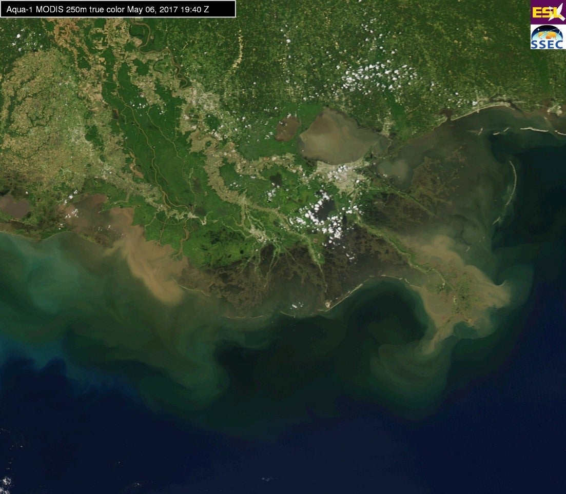
MODIS Imagery of Louisiana on May 6, 2017 from Louisiana State University’s Earth Scan Laboratory (https://www.esl.lsu.edu/imagery/MODIS/2017/05/6/) The river discharge was at 730,000 cubic feet per second, discharge 183,000 at Morgan City and 186,000 at Wax Lake.
The U.S. Army Corps of Engineers began inspections along the Mississippi River on May 4th in response to the rising river. In Baton Rouge, the river stage is predicted to peak at 41 feet on May 27th. While a river stage of 41 feet is considered a major flood stage at Baton Rouge, the river discharge is not expected to reach the 1.5 million cubic feet per second that would trigger the opening of the Morganza Spillway. In New Orleans, the river is predicted to peak at 16.5 feet on May 29th. This would translate to more than 1 million cubic feet of water—the equivalent of 11 Niagara Falls passing by New Orleans. Flow rate and river stage are both important in determining whether to open the spillways. While a lot of water is coming down the Mississippi, it’s slow and steady. The Army Corps of Engineers is not expected to open the Bonnet Carré Spillway, at this time.
A high river flow peak typically occurs on the Mississippi River in the spring, resulting from rainfall and snowmelt throughout the drainage basin. However, the river often has more than one peak over the course of the year. And, as the river flow rises, the amount of sediment carried by the river also generally increases. At Belle Chasse, the USGS tracks river discharge and turbidity. While turbidity is a measure of water clarity, not sediment, scientists can collect measurements in the field to relate turbidity and sediment concentration in the water.

Discharge and Turbidity data from USGS Belle Chasse, LA station (https://waterdata.usgs.gov/la/nwis/uv/?site_no=07374525&PARAmeter_cd=00065,72020,63160,00060)
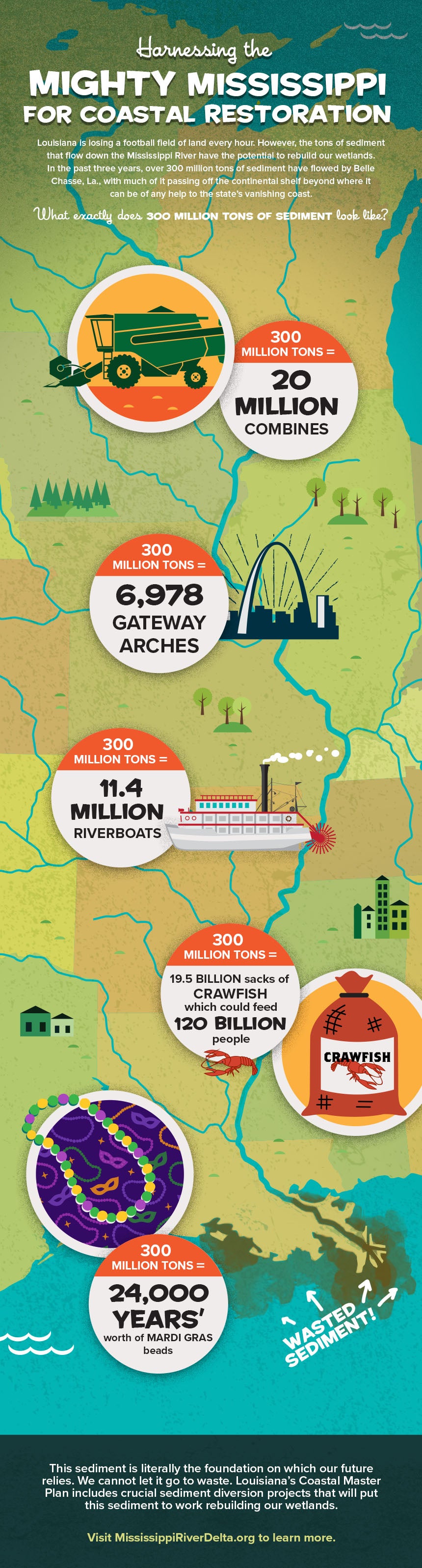
Sediment is a critical ingredient for the long-term survival of Louisiana’s coast. Diverting the large amounts of clay, silts and sand carried by the river during peak flow times into adjacent sediment-starved wetlands is necessary for restoring these crucial coastal areas that protect our communities. A recent report, Building Land in Coastal Louisiana: Expert Recommendations for Operating a Successful Sediment Diversion that Balances Ecosystem and Community Needs, suggested different strategies of how to take advantage of these river peaks to build land and mitigate negative effects.
Before the river levees were constructed along the Mississippi, high river discharges often overtopped the river’s banks, delivering sediment and fresh water over large areas of Louisiana’s coast. The levee system built along the Mississippi River, along with flood control outlets, have made it possible to successfully manage floodwaters to protect nearby communities and provide a reliable river navigation system. However, the levees have also cut off the flow of sediment needed to build and maintain Louisiana’s coast. Sediment diversion projects, operated thoughtfully, can be integrated into the levee system, serving the needs of flood protection, navigation, and restoration.