| Projects Types in This Basin |
|
|
|
|
 Hydrologic Restoration
 Marsh Restoration
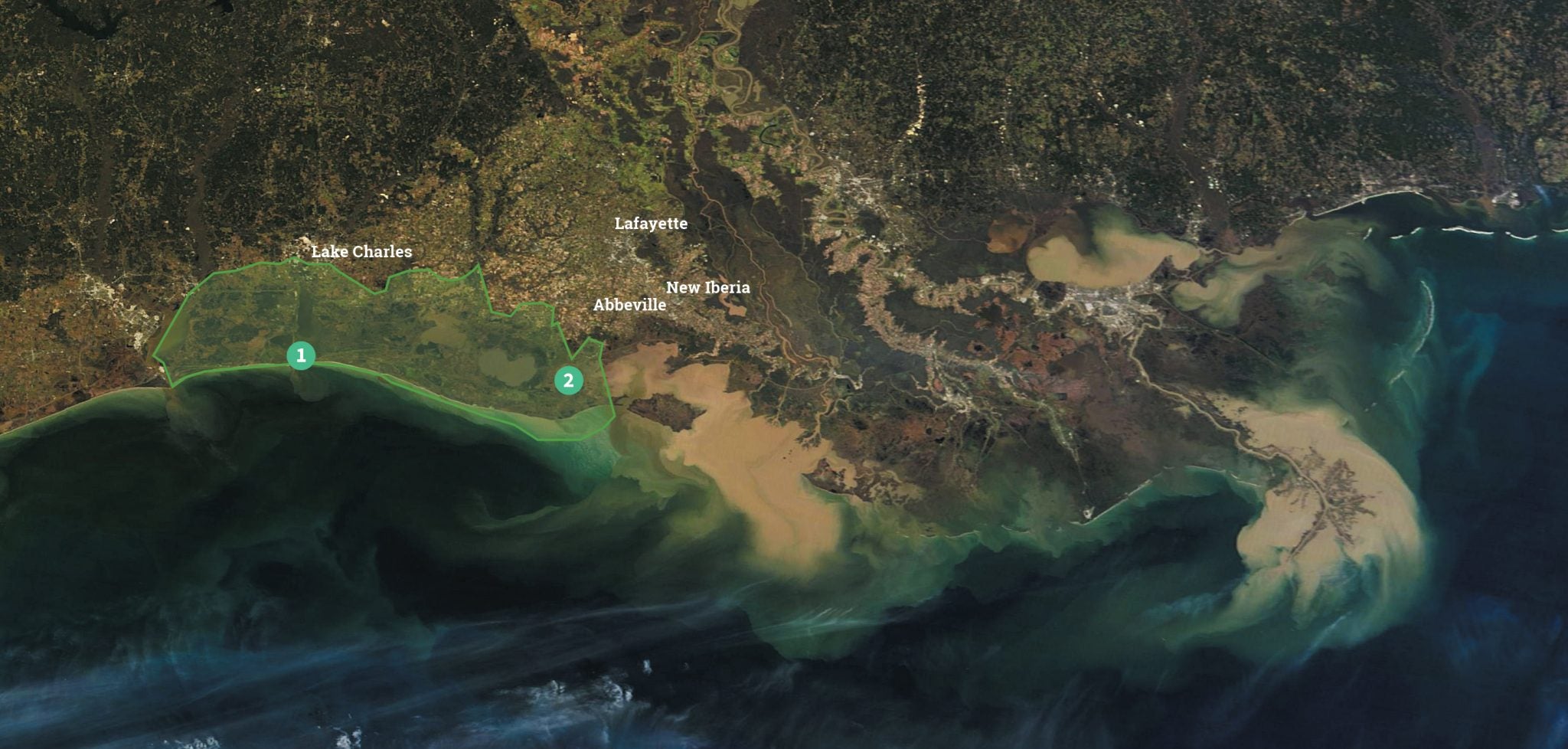
The Chenier Plain in southwestern Louisiana was built by sediment drifting westward over the last 7,000 years from the shifting deltaic lobes of the Mississippi River as well as the Atchafalaya River distributary. Cycles of shoreline erosion and sediment deposition built ridges, or cheniers, running east-west between wide expanses of marsh. Sediment transport westward along the coast from both the Atchafalaya and Mississippi rivers has been limited by coastal infrastructure.
The Chenier Plain is characterized by fresh to brackish marshes and interior lakes that are fed by the Vermilion, Mermentau, Calcasieu and Sabine rivers. But for decades, navigation features, such as the Calcasieu Ship Channel, Sabine Waterway, the Mermentau Navigation Channel and the Freshwater Bayou Canal, have allowed salt water from the Gulf to penetrate formerly freshwater marshes. Today, the Chenier Plain is being overwhelmed by saltwater intrusion, leading to widespread marsh loss, while the jetty systems of the many navigation channels have interrupted the flow of sediment from east to west.
The priority projects chosen in this basin include Calcasieu Ship Channel Salinity Control Measures Hydrologic Restoration, which focuses on increasing sustainability of the basin by reducing tidal action and interior salinity to marshes and water bodies adjacent to Calcasieu Ship Channel. In addition, Freshwater Bayou North Marsh Creation project will build land quickly, creating critical wetland habitat and maintaining hydrologic barriers between inland lakes and navigation channels.
Our 2017 Coastal Master Plan Priority Projects
Projects in the Chenier Plain
- Calcasieu Ship Channel Salinity Control Measures Hydrologic Restoration
The Calcasieu Ship Channel, which connects the Gulf of Mexico to Calcasieu Lake, is located within the Chenier Plain. The once stable platform of the Chenier Plain has experienced decades of dredging navigation canals, which has dramatically changed the hydrology of the system. Saltwater intrusion led to the extensive loss of freshwater marshes, increasing the threat of storm surge to communities. This project will aim to isolate the ship channel through a network of dike and sill structures designed to limit saltwater intrusion through the Calcasieu Ship Channel and into adjacent marshes. This project will also support storm surge protection by increasing the sustainability of adjacent marshes and dissipating wave energy and tidal flows within the ship channel. - Freshwater Bayou North Marsh Creation
Freshwater Bayou North Marsh Creation is planned for Vermilion Parish, just west of Freshwater Bayou and north of the bayou locks. The project is one of the largest and fastest land-building priority projects, projected to build around 9,000 acres upon construction. It will restore marshes degraded by hurricanes Rita, Gustav and Ike and prevent Freshwater Bayou from continuing to enlarge and further erode interior marshes. Sediment will be delivered via pipeline to the site from either the Gulf of Mexico or the Freshwater Bayou Canal. The newly created marsh will protect against storm surge, wave energy and flooding. It will also foster nutrient transport, vegetation growth and soil accretion, helping set the marsh on a path to rebuilding rather than washing away.