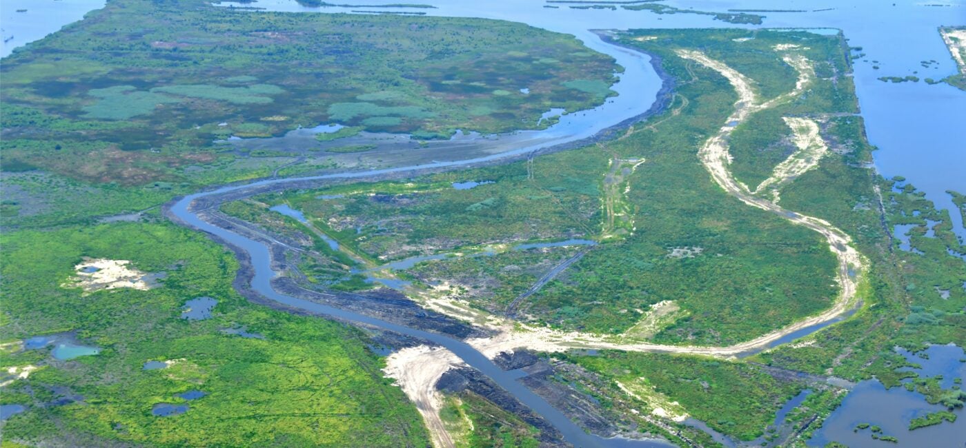
Project construction complete.
About This Project
Project ID: CMP ID: 090c
Parish: Jefferson, Lafourche, Plaquemines
Type: Marsh Creation
From the 2023 Coastal Master Plan
Region: Barataria
Parish: Jefferson, Plaquemines
CMP ID: 090c
Project Type: Marsh Creation
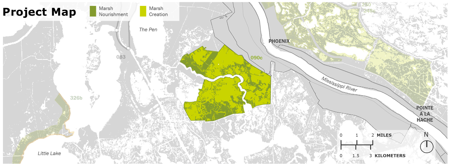
Description: Creation of marsh within a footprint of approximately 15,000 acre in western portion of Large-Scale Barataria marsh Creation project to create new wetland habitat, restore degraded marsh, and reduce wave erosion.
CPRA Project Factsheet
Project Implementation
Project 1: Large-Scale Barataria Marsh Creation Component-E
Project ID: BA-0207
Project Parish: Jefferson
Land Benefit: 1163 acres
Status: Complete (2023)
Funding Source: NRDA
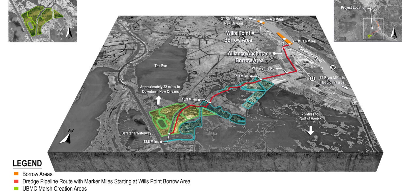
Description: This project, also known as Upper Barataria Marsh Creation, involves the creation of approximately 1,163 acres of marsh near the south shore of The Pen in Jefferson and Plaquemines parishes using sediment from the Alliance Anchorage and Willis Point Anchorage borrow areas. The project is an increment of the Large-Scale Marsh Creation Project Component E identified in the NRDA Draft Strategic Restoration Plan for the Barataria Basin.
Project 2: NE Turtle Bay Marsh Creation
Project ID: BA-0206
Project Parish: Jefferson
Land Benefit: 372 acres
Status: Completing permitting
Funding: CWPPRA
Description: The proposed project would create approximately 377 acres and nourish approximately 300 acres of marsh in Northeast Turtle Bay in Jefferson Parish using sediment dredged from Turtle Bay. Two types of containment will be utilized for this project: semi-contained and fully contained. Approximately 2,870 feet of critical shoreline would be protected and two channel liners would be installed to prevent further enlargement of two primary water exchange points.
Project 3: NE Turtle Bay Marsh Creation Extension
Project ID: BA-0258
Project Parish: Jefferson
Land Benefit: 343 acres
Status: Engineering & Design
Funding: CWPPRA
Description: The goal of the project is to restore low salinity brackish marsh along the Barataria Basin Landbridge with dredged material from Turtle Bay. This project will create approximately 362 acres and nourish approximately 61 acres of marsh (423 acres total). The project will result in approximately 343 net acres over the 20-year project life.
Updates
Project 1: Large-Scale Barataria Marsh Creation Component-E
- 05/01/2023
- 05/01/2022
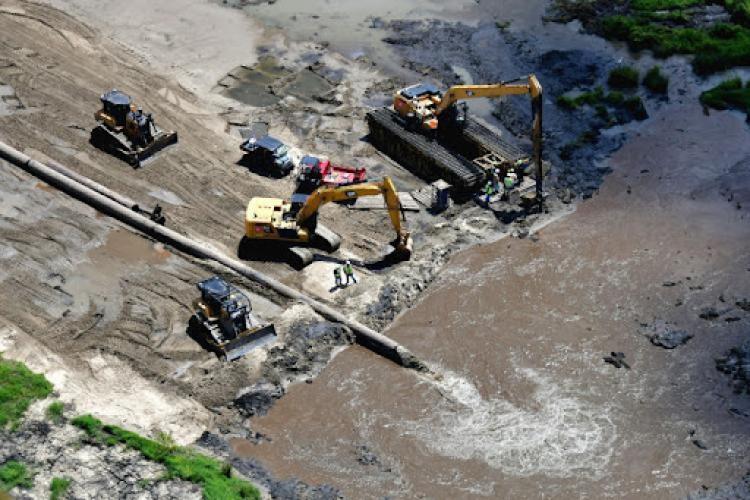
Contractor dredged sediment from the Mississippi River and pumped to contained areas for marsh creation.
- 01/01/2021
Began construction of an earthen dike to contain dredged material.
- 11/01/2021
The project contractor, Weeks Marine, Inc., assembled equipment at the project site and began construction.
Project 2: NE Turtle Bay Marsh Creation
- 01/29/2025
Project still in holding pattern due to land rights.
- 09/11/2023
Permit modifications received, project in holding pattern as land rights discussions continue.
- 04/25/2023
Permits still undergoing updates to the impacts of Hurricane Ida. Land rights/servitudes agreements for the project in progress.
- 07/06/2022
Engineering and design for the project nearing completion, but project team had to conduct a complete survey due to changes associated with Hurricane Ida that would impact the design of the project.
- 02/03/2022
Project approved for CWPPRA Phase 2 construction funding at $32,241,815.
- 12/19/2021
Project selected for CWPPRA Phase 2 construction funding.
- 02/21/2018
Project received Phase 1 E&D funding from the CWPPRA program for PPL27.
Project 3: NE Turtle Bay Marsh Creation Extension
- 04/17/2025
Due to the issues with the landowner still being unresolved across all restoration projects, the design is now on hold until those issues are resolved.
- 07/30/2024
Nearing completion of a geotechnical report and 30% E&D review. Anticipating a CWPPRA Phase 2 construction request in December of 2025.
- 04/04/2024
30% E&D review to be completed by February/March of 2025.
- 06/05/2023
Geotechnical work has begun.
- 02/03/2022
Approval of CWPPRA Phase 1 E&D funding of $3,591,775.
- 12/09/2021
Received CWPPRA Phase 1 E&D funding under PPL31.
What is a Marsh Creation Project?
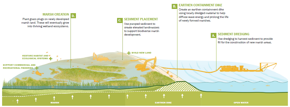
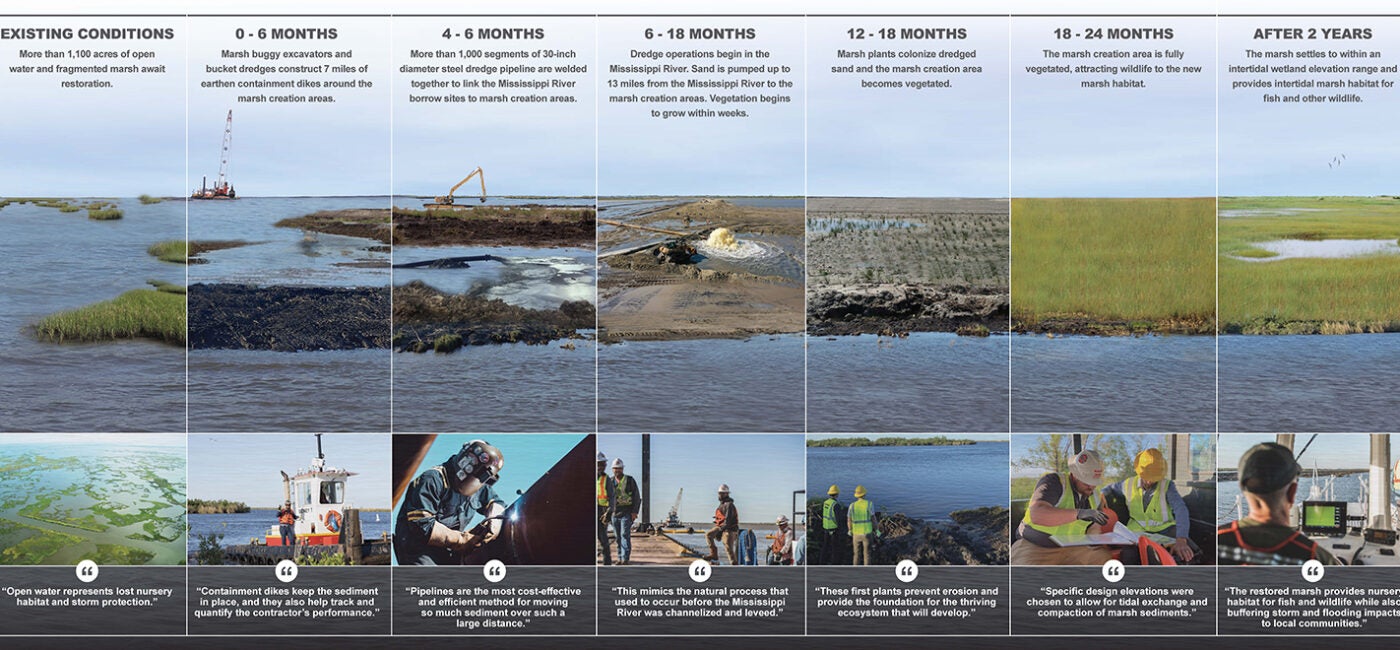
Graphic by SCAPE, published in 2023 Coastal Master Plan.
Marsh creation or “dredging” uses sediment from the Mississippi River, nearby water bottoms or offshore shoals to build land in shallow, open water areas, typically where land has been lost. These projects can build land fairly quickly, but will eventually fall victim to the same process that caused the land to disappear originally. This type of project can be used in conjunction with sediment diversions to trap sediment, and sediment diversions can lengthen the lifespan of marsh creation projects by providing a continual source of sediment to the new marsh surface.
Other Marsh Creation Projects
New Orleans East Marsh Creation | Central Wetlands Marsh Creation and Diversion | Three Mile Pass Marsh Creation and Hydrologic Restoration | Delacroix Marsh Creation | East Bayou Lafourche Marsh Creation | Calcasieu Lake Marsh Creation | Belle Pass-Golden Meadow Marsh Creation | Calcasieu-Sabine Large-Scale Marsh and Hydrologic Restoration Project | Golden Triangle Marsh Creation
Supporter Spotlight
Lauren Averill
