Upriver Diversions Can Reduce Impacts of Bonnet Carré Spillway
New research shows river diversions can restore vital wetlands and reduce impacts of Bonnet Carré Spillway openings
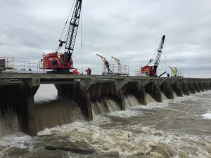
Climate change is causing more intense rainfall across the Mississippi River Basin resulting in more river floods and more frequent use of the Bonnet Carré Spillway. The spillway is a massive flood control structure operated by the U.S. Army Corps of Engineers when the river reaches a certain flood stage to reduce pressure on the levees and prevent catastrophic flooding to more than 1 million people across Orleans, St. Bernard and Plaquemines Parishes.
At the same time, opening of the Bonnet Carré spillway can cause shifts in salinities and other changes resulting a range of issues that extend beyond Louisiana.
To identify solutions to confront the more frequent spillway openings, our coalition tasked Tulane University scientists with exploring how planned wetland restoration projects in Louisiana could also limit potential impacts of spillway openings.
Their findings offer hope in the form of two river diversions located upriver from the Bonnet Carré Spillway and included in Louisiana’s Coastal Master Plan. According to the modeling, operating these diversions at the time of a river flood can significantly reduce the impacts of spillway openings, while also achieving their primary purpose of restoring hundreds of thousands of acres of vital wetlands in Louisiana.
What are the upriver diversions?
The Ama Sediment Diversion will divert sediment, nutrients, and freshwater from the Mississippi River to existing wetlands in the upper Barataria Basin and benefit marsh creation projects further down in the basin. With a maximum capacity of 50,000 cubic feet of water per second, the project is expected to build and sustain wetland forests, fresh and intermediate marshes by increasing sediment input, water flow and nutrients in the basin. The diversion is expected to build or maintain 76,600 acres of wetlands over 50 years.
Ama Diversion project site and impact area:
Union Diversion project site and impact area:
Key findings: Upriver diversions offer hope for restoration and river management
The first phase of our modeling study found that when both Ama and Union diversions are operated jointly, they distributed floodwaters upriver of the spillway and reduced the volume of water flowing through the Bonnet Carré Spillway by almost 60%. Based on the significant findings from the first phase of the study, the State of Louisiana’s Coastal Protection and Restoration Authority included the Union Upper River Diversion in their annual funding plan for feasibility and planning.
In this most recent phase of the study, researchers developed a 3D process-based Delft3D model to quantify the basin-side effects. Their initial findings were very promising, indicating:
“Releasing water through the upper river diversions (Union and Ama) allows for Mississippi River freshwater, nutrients and sediment to be routed through wetland areas in need of these resources. These wetland areas (Maurepas fresh swamps and upper Barataria) will filter out sediment and nutrients from the water column before reaching the Gulf of Mexico. Further, routing the freshwater through these upper basins and the associated reduction in the magnitude and duration of the Bonnet Carré pulse, will have positive impact on the salinity and nutrient regime for Lake Pontchartrain and the State of Mississippi’s coastal zone.”
What’s next?
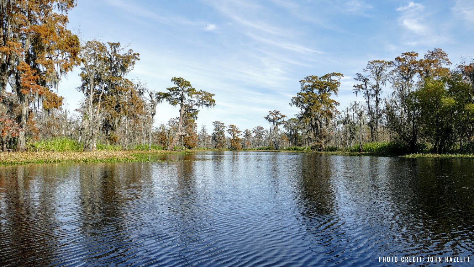
The Union Freshwater Diversion will move fresh water from the Mississippi River into Maurepas Swamp.
Looking forward, the development and calibration of this model will provide a valuable predictive tool to answer restoration and river management questions such as:
- Does releasing water through the upper river diversions (Union and Ama) allow Mississippi River sediment to be routed through wetland areas in need of these resources?
- Does diverting freshwater, sediment, and nutrients to the Maurepas Swamp and the upper Barataria marshes, create added protection benefits to local communities from natural hazards including sea-level-rise, hurricanes and rainstorm flooding?
- Do these wetland areas (Maurepas fresh swamps and upper Barataria) filter out sediment and nutrients from the water column before reaching the Gulf of Mexico?
- Does diverting freshwater through the Barataria Basin and away from the Pontchartrain and Breton Sound, reduce the salinity impacts on the eastern side of the Mississippi River basin especially near the State of Mississippi coastal zone?
Louisiana’s coast and climate are changing rapidly, requiring new and innovative approaches to confront challenges of flooding, wetland loss and ecosystem health. State and federal leaders have an opportunity to confront these rapid changes with novel, comprehensive solutions that go beyond the traditional flood management and risk reduction strategies of the previous century and prioritize ecosystem restoration to provide multiple benefits to people and nature. The findings of this study provide one clear pathway for moving in that direction.