Louisiana’s Barataria Basin has experienced some of the highest rates of land loss on the planet: Between 1932 to 2016, the region lost nearly 295,000 acres of land, displacing communities, threatening critical infrastructure and jobs, and decimating formerly diverse and abundant wildlife habitat.
Louisiana’s bounty – its fisheries, wildlife, and abundant natural resources – are at risk of complete collapse without large-scale restoration projects like the Mid-Barataria Sediment Diversion. This project is a crucial step in turning the tide on the state’s land loss crisis and protecting vulnerable communities from hurricanes and sea level rise, while also ensuring the long-term health of the ecosystem and wildlife in the face of a changing climate and coast.
The Mid-Barataria Sediment Diversion is the single largest ecosystem restoration project in the history of the U.S. This project will build more wetlands than any other individual restoration project in the world, and it is exactly the scale of project we need to address the very serious challenges we face.
Learn more about the project on the CPRA website | What supporters are saying about sediment diversions
What’s at Stake
The unique cultures and way of life for millions of Louisianians are inextricably connected to the natural resources and protection of the state’s coast.
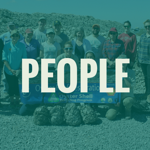
People
 Coastal Louisiana is a place like nowhere else in the world. At the same time, our coastal communities are at grave risk from land loss, hurricanes and rising seas. Barataria Basin alone could lose an additional 550 square miles of land over the next 50 years, a nightmare scenario that would jeopardize the safety and prosperity of the entire region, threaten our culture and entire way of life, and eviscerate coastal habitat that wildlife need to survive. The Mid-Barataria Diversion will build and sustain wetlands in the Barataria Basin that provide storm protection for communities from the small towns of Lafitte to population centers like Belle Chasse and for the larger Greater New Orleans region.
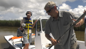
It’s vital we restore and protect our coast for people like Dr. Alex Kolker, a coastal geologist and associate professor at LUMCON in Cocodrie, Louisiana who works on the edge of the world. He knows the crisis – and the science – behind coastal land loss as well as anyone. Does he trust the science behind the Mid-Barataria Sediment Diversion? In his own words:
As a scientist and educator, I appreciate the questions that have been raised about diversions, because they force the scientific community to look critically at the science underlying our coastal knowledge, and to field test ideas about how nature works. After taking our test, large diversions passed.
You can also watch Dr. Kolker in last year’s series Last Call for the Bayou. These five films went beyond the oft-cited statistics of Louisiana’s land loss crisis to deliver striking images and moving stories of the people on the frontlines. Follow Dr. Alex Kolker on his mission to save Louisiana’s coastal landscape in Mud, Sweat and Fears for free on the Smithsonian Channel.
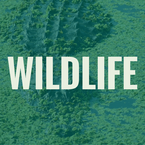
Wildlife
Louisiana’s bounty — its fisheries, wildlife habitat, and abundant natural resources — are at risk of complete collapse without large-scale restoration projects like the Mid-Barataria Sediment Diversion.
Since leveeing of the Mississippi River, the Barataria Basin has become saltier, causing saltwater species to shift northward from the Gulf toward New Orleans. Meanwhile, freshwater species have lost habitat as the historically fresher areas of the basin have become more salty. Without restoration, these changes will continue, resulting in a loss of species that rely on productive freshwater and intermediate wetland habitats.
Large-scale diversions like Mid-Barataria provide multiple benefits by building and sustaining thousands of acres of wetland habitat. At a basin-wide scale, the diversion will help sustain diverse coastal ecosystems that contain numerous species of fish and wildlife.
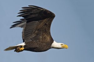
One species that thrives in the freshwater upper reaches of the Barataria Basin is the iconic Bald Eagle. The vast majority of these nesting Bald Eagles are found in Louisiana’s coastal freshwater wetlands, and we risk seeing a reduction in population if we continue losing these freshwater habitats. In contrast, the Mid-Barataria Sediment Diversion will freshen the upper estuary and is predicted to expand the availability of suitable Bald Eagle nesting and foraging habitat.
Economy
 The Mississippi River Delta is an economic engine that feeds and fuels the nation, and its ports connect the U.S. with the world. Protecting billions of dollars of existing infrastructure and industry while growing jobs through a restoration economy are two major benefits of large-scale restoration.
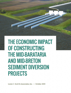
The positive economic impacts of constructing the Mid-Barataria sediment diversion will be significant and will be felt within Plaquemines Parish and across the broader region. Over this five-year construction phase of the project:
- The Mid-Barataria Sediment Diversion is a $1.4 billion investment over several years
- Regional businesses will see a $1.9 billion increase in sales
- Household earning will rise $503 million for citizens of the area
- Approximately 1,963 jobs will be supported annually
Read more about the economic impact of the construction of sediment diversions.
A Game-Changer for Louisiana’s Coastal Crisis

The Mid-Barataria Sediment Diversion is an innovative, widely studied, and proven project – and it is our best shot at a vibrant and resilient future for communities, fish and wildlife habitat and the multi-billion dollar economy that depends on a healthy Mississippi River Delta.
Since diversions reestablish natural deltaic processes and continuously build land over time, they provide long-term benefits that constructed marsh creation projects alone do not. Sediment diversions provide a regular supply of sediment and fresh water to wetlands, sustaining traditional marsh creation projects while also building new land. Plus, using the river as a resource allows for more land-building potential than we could get with dredges alone – and it can do it at a fraction of the price tag.
The Mid-Barataria Sediment Diversion will be strategically located and adaptively managed, meaning we can change how the project is working based on monitoring environmental and resource conditions. This flexibility will help the diversion ensure the overall goals for building and sustaining land are achieved, while also factoring in the needs of communities, fisheries, navigation, and other economic and social concerns. For decades, scientists and engineers have considered all the tools available and agree that this project is the best solution to match the challenges we face from land loss, sea level rise and climate change. This is our best shot.
Want more details on the science and operations of the Mid-Barataria Sediment Diversion?
The Future of our Coast: It’s Up to Us
A picture is worth a thousand words, but let’s be clear: Louisiana’s coast has lost nearly 300,000 acres of land since the 1930s. Without action, Barataria Basin alone could lose an additional 44 square miles of land in the next 20 years and 428 square miles of land over the next 50 years, a nightmare scenario that would jeopardize the safety and prosperity of the entire region, threaten our culture and entire way of life, and eviscerate coastal habitat that wildlife need to survive.
But the Mid-Barataria Sediment Diversion will have major, beneficial impacts to land-building in the Barataria Basin compared to a future without the project. It will build and maintain 17,300 acres of wetlands within 30 years of the project’s initial operations, deliver 310 million cubic yards of sediment into Barataria Basin within 50 years of operation, and increase elevation of land near the outfall area by 3.6 feet within 50 years.
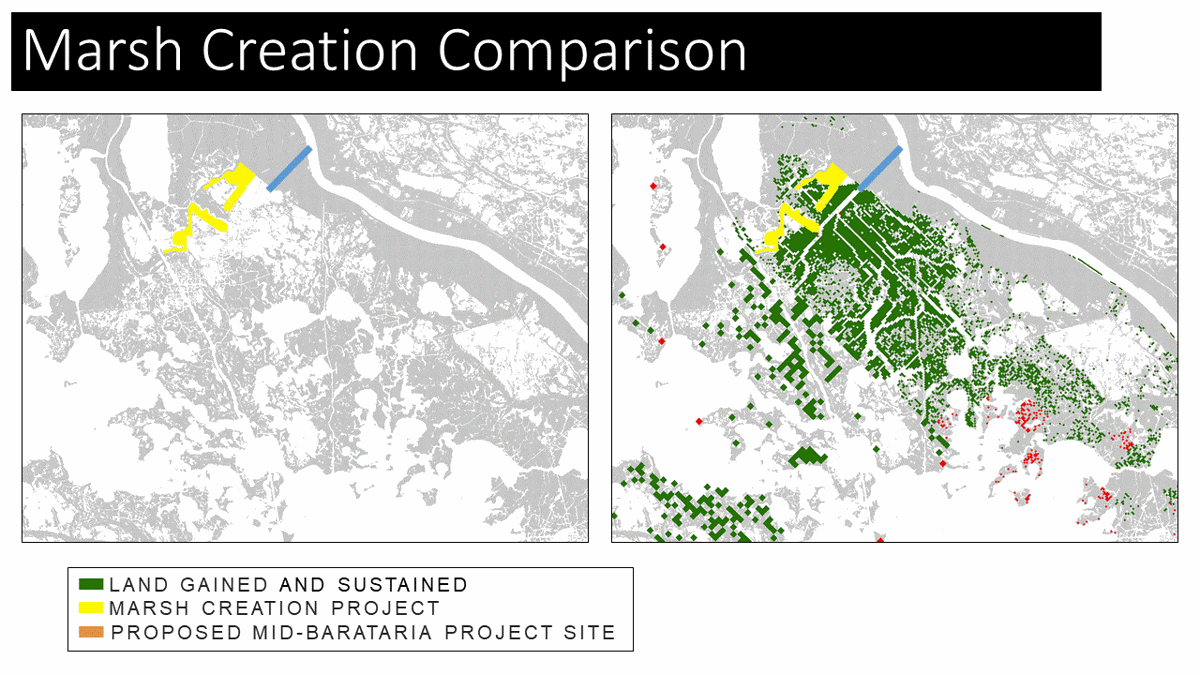
This graphic shows the model results of land created or conserved by the proposed Mid-Barataria Sediment Diversion over 50 years, right, compared to land built by dredging from the Mississippi River and pipelining it inland, left. The red dots are land lost as a result of the diversion operation. (Graphic from Coastal Protection and Restoration Authority)